Archaeological Survey & Inventory
 There are over 27,000 archaeological sites on file with the Department of Archaeology and Historic Preservation (DAHP). The earliest reports date from the 1890s. Each month an average of 30 new sites are recorded with the office.
Archaeological surveys to locate sites are undertaken by archaeologists employed by a wide variety of agencies and the private sector. Most major federal land management agencies have archaeologists on staff to survey their land holdings. All universities in the state have archaeologists who conduct research and frequently hold summer field schools involving archaeological surveys. Some tribes in the state have their own staff archaeologists and private archaeological consultants conduct surveys for clients involved in specific development projects. Numerous archaeologists are in the field everyday looking for sites. Sites can be discovered during construction projects and/or reported by the public.
A professional archaeological survey involves several distinct steps. First, before going into the field, the archaeologist reviews existing information, site records from the general area, historical documents, and summaries of archaeological research about the kinds of sites that were previously found. Other sources of information include ethnographic accounts of tribes, land records, and aerial photographs. Topographic maps may help archaeologists identify specific landforms or locales in the project area that should be closely inspected. Other tasks include activities such as securing the landowners permission and contacting the concerned tribes and other parties or knowledgeable researchers who have an interest in the project.
Based upon the literature and records review, the archaeologist develops a research design that details what he or she is expecting to look for, what actual methods he or she will employ to conduct the search and how he or she will record what they find.
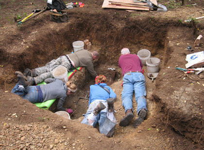
The second step is the actual survey. This requires the archaeologist to physically inspect the project area according to a developed survey methodology. Most commonly, the archaeologist walks over the entire project area in evenly spaced transects. Depending upon the vegetative cover and soils, the archaeologist may systematically dig auger or shovel probes into the soil to search for artifacts or evidence of human activity. If an archaeological site is found, the archaeologist will obtain specific kinds of information in order to record the site with DAHP. If more archaeological work is needed, a permit for digging will be issued by DAHP. The site form includes basic location and descriptive information about the archaeological site.
The third and final step is the writing of the survey report. This report summarizes the archaeologist's research and field efforts, details his or her findings and offers specific recommendations for further steps. The report will be filed with the landowner or manager and DAHP. Even when no sites are found a survey report is required to detail the actual areas inspected and the methods that were followed.
Contemporary archaeology stresses a conservation ethic. The goal of modern archaeology is to find and document those special places of our past to protect them for the future and to serve as focal points for us in the present to learn and appreciate our common past.
Please note that DAHP requires the exclusive use of DAHP Archaeology Site Forms for all archaeological survey projects.
Archaeological Site Forms
- Archaeological Excavation Permit Application
- Archaeology Site Form - Now on Wisaard!
- Submerged Historic Archaeological Resource Registration Form
- Smithsonian Number Merger Form
- Merging of Archaeological Smithonian Number Policy
Guides
- WA State Standards for Cultural Resource Reporting
- A Field Guide To Washington State Archaeology
- Centennial Accord Plan
- ACHP Guidance on Tribal Consultation by Federal Agencies
- ACHP Guidelines on Traditional Cultural Properties
- Washington Statewide Archaeology Predictive Model Report - June 2009
- Cultural Resource Risk Assessment Model - November 2025


