Geographic Information System & Information Technology Program
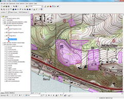
The Washington State Department of Archaeology and Historic Preservation (DAHP) geographic information system (GIS) Initiative is a set of tools and web applications that help public agencies and Washington State residents design projects to avoid damage to archaeological and historic sites during the environmental planning process. The main tool is our WISAARD system, which contains the full inventory of historic and archaeological resources as well as culatural surveys and state and National register listings. This system represents the next generation of digital cultural resource management tools.

Public Cultural Resource GIS Layers
We offer free access to our publicly available data via ArcGIS Online (links below). Because of the potential for vandalism and looting, archaeological site locations are not publicly available. However, archaeological information is shared with a variety of local governments, agencies, tribal governments and academic institutions by means of a Memorandum of Understanding (MOU) to ensure state and federal laws are followed.
DAHP has developed several GIS layers (Metadata) for inventoried historic properties and registered historic sites. The following non-archaeological GIS layers are available for download without a DAHP data sharing agreement:
- Historic General Land Office Plat Maps - Map Service is temporarily unavailable. Some of the maps can be viewed in Wisaard.
- GLO Trails
- GLO Surveyor Information - thanks to Jerry Olson for his kind permission to access his material
DAHP - Register Properties
DAHP - Register Districts
DAHP - Historic Property Inventory
These GIS layers are updated on a quarterly basis.
For general information about our GIS program contact Morgan McLemore at (360) 972-4007 or Morgan.McLemore@dahp.wa.gov.
DAHP on a MAP - Currently unavailable - UPDATE COMING SOON!
DAHP collects and administers data for all programs that we administer, including grants, Federal Rehabilitation Tax Credits, Human Remains cases, regulatory compliance, Certified Local Governments, Main Street, and archaeological permitting. We use this data to report on our activities to the legislature as well as the National Park Service to illustrate our progress toward meeting federally mandated program goals. Maps can be useful to illustrate where historic preservation funding is going, and maybe more importantly, where it is not going, helping us all to target outreach to communities that may be underserved. To that end, we have created an easy to use interactive mapping application to view data related to what we do. Click on the BLUE button at the bottom of the map for instructions.


